Zulu for Pilots is an interactive map that displays user-friendly NOTAMs issued by NAV CANADA for Canadian pilots.
Pilots are advised to obtain all pertinent NOTAM information from Flight Information Centres / Flight Service Stations (FIC/FSS) prior to flying. The user accepts sole responsibility and all risks associated with use of the information on this web site. The user expressly releases Imaginex Engineering Inc, its employees, agents and assigns from any liability or obligation in respect thereof.
Effort was made to ensure that all NOTAMs presented on Zulu for Pilots will continue to remain accurate. The presentation of NOTAM information is controlled by Zulu for Pilots therefore NAV CANADA cannot be held liable for the accurracy of this web site. With that being said, Zulu for Pilots should then be used as an additional resource in your “flight planning toolbox.” You should also refer to NAV CANADA’s website at www.navcanada.ca or call a specialist at your nearest FSS/FIC (1-866-WXBRIEF).
Be smart. Double check everything. Fly safe.
Using Zulu for Pilots is easy.
You can search for Canadian aerodromes either by their respective ICAO code, name or by navigating the map. Canadian navigation aids can be searched by either their respective ICAO code or by navigating the map.
The names of aerodromes and navigation aids are displayed on the website as they appear in the Canadian Flight Supplement (CFS) or in the Water Aerodrome Supplement (WAS). Considerations were made to ensure that searching would be easy and hassle free.
Including diacritic marks in your search query is optional. Searching "Aéroparc Île Perrot" or "Aeroparc Ile Perrot" will result in finding the same aerodrome.
Abbreviated words such as HOSP, MUNI and INTL can also be searched using their respective expanded form.
For example, searching for "Toronto INTL" would yield the same results as searching "Toronto International".
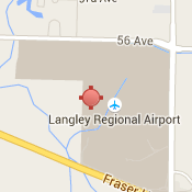
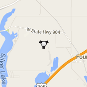
Aerodromes and navigation aids are represented on the map by markers and come in 2 colours: red and white.
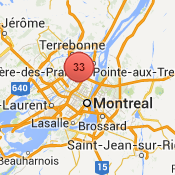
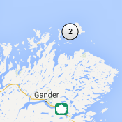
In order to prevent markers from overcrowding the map when zooming out, Zulu for Pilots will group markers together into clusters based on proximity. The number in the middle of the cluster represents the number of aerodromes and navigation aids that were grouped together. The color scheme of clusters are the same as individual aerodrome and navigation aid markers.
Clicking on a marker will display a side bar with all NOTAMs for the respective aerodrome or navigation aid.
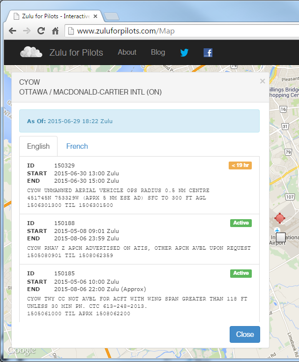
For convenience, notams are ordered from newest to oldest.
An Active badge will appear beside each active NOTAM. A NOTAM is considered active if it meets one of the following conditions:
Active badges do not apply to RSC (Runway Surface Condition) NOTAMs.
NOTAMs that will become active beyond 24 hours will show a > 24 hr badge. Within 24 hours of becoming active, a Time To Activation badge will appear.
An Age badge will appear beside each RSC (Runway Surface Condition) NOTAM. The age of an RSC NOTAM is the span of time from the NOTAM filing date with the NOTAM Office to the present time.
NOTAMs are distributed to Zulu for Pilots directly from NAV CANADA through the Aeronautical Fixed Telecommuncation Netwrok (AFTN). This infrastructure ensures that all NOTAM information received are complete, accurate and timely.
You can read more about the AFTN infrastructure at Wikipedia.
Any reproduction on this web site of NAV CANADA data is not represented as an official version of the materials reproduced, nor as having been made, in affiliation with or with the endorsement of NAV CANADA. Please visit www.navcanada.ca for the terms of use of NAV CANADA data.
Aeronatuical data for aerodromes and navigation aids come from the Canadian Flight Supplement (CFS) and Water Aerodrome Supplement (WAS).
We want to help the Canadian aviation community by building tools that are effective and easy to use. We strongly believe that if a tool makes your life easier than you will use it. This is why we appreciate any feedback!
So please send your ideas, complaints, bugs, etc. to feedback@imaginex.ca.
Thank you!